Mount St Peter - Maastricht
By Jannick Siderius
A short overview of natural and man-made developments around Mount St Peter.
Early history
Mount St Peter is part of the Plateau of Caestert, a ridge of hills formed by the river Maas and Jenker. The Plateau is approximately 132ha big and lies partly in The Netherlands, Wallonia and Flanders. This area was formed in the Cretaceous period (from 145 to 66 million years ago) and the ground contains mostly marlstone, flint, silty loess and sandy soils. Because of the relatively dense stone and soil, underground caverns and caves formed throughout the Plateau of Caestert. These so called Karsts form when stone is chemically dissolved, and leave small fractures and rifts in the surface.
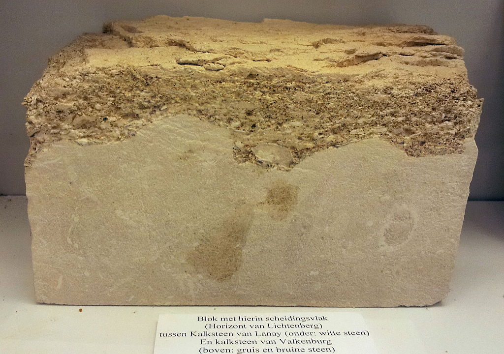 Marlstone block containing two types of chalk. Comparable to stone at Mount St
Peter. Image courtesy of Kleon3 [10]
Marlstone block containing two types of chalk. Comparable to stone at Mount St
Peter. Image courtesy of Kleon3 [10]
Early quarries
The mining of marlstone began at some point in the 16th century AC. The stone was mainly used as building material or as chalk fertilizer on neighbouring farms. The first quarries were underground; the miners built them right into the hillside and extracted stone through a series of tunnels. Only once century later, around 1640, the tunnel network had already massively grown to about 150km in length (pictured to the left). Additionally, some quarries had their own (smaller) tunnel systems.
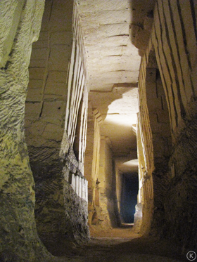 Underground quarry at Mount St Peter. Mining activity of marlstone blocks can be
clearly seen. Image courtesy of Kevin Amendt [5]
Underground quarry at Mount St Peter. Mining activity of marlstone blocks can be
clearly seen. Image courtesy of Kevin Amendt [5]
Industrialized quarry
In 1924, the 'First Dutch Cement Industry' (ENCI) started exploiting the marlstone and limestone located in Mount St Peter. While there had been smaller quarries, this was the first time that the resources were industrially mined. The ENCI quarry was a surface quarry, in contrast to the underground marlstone mining that had commenced at Mount St Peter before.
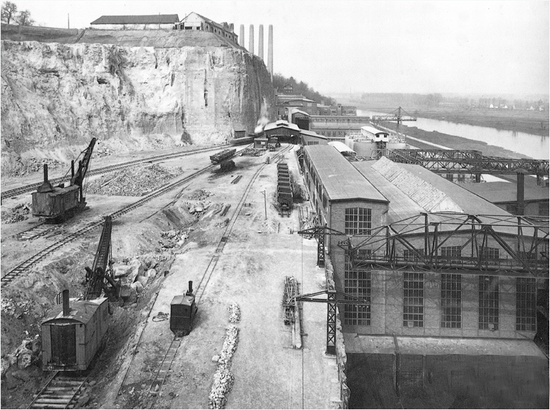 ENCI quarry and cement factory in 1930. First surface mining of Mount St Peter
clearly visible. Image courtesy of Bouwmachines van Toen [11]
ENCI quarry and cement factory in 1930. First surface mining of Mount St Peter
clearly visible. Image courtesy of Bouwmachines van Toen [11]
Quarry development
ENCI had ownership over approximately 150 hectares of the resources located around Mount St Peter. This enabled them to produce close to 900.000 tons of portland cement and 1.200.00 tons of cement per year at the height of their production (2007).
Quarry closure
In 2018, after repeated environmental impact studies and protests against the mining operations, the exploitation of the quarry was definitively halted. In subsequent years, restoration works were undertaken to restore some of the nature that was removed due to quarry works.
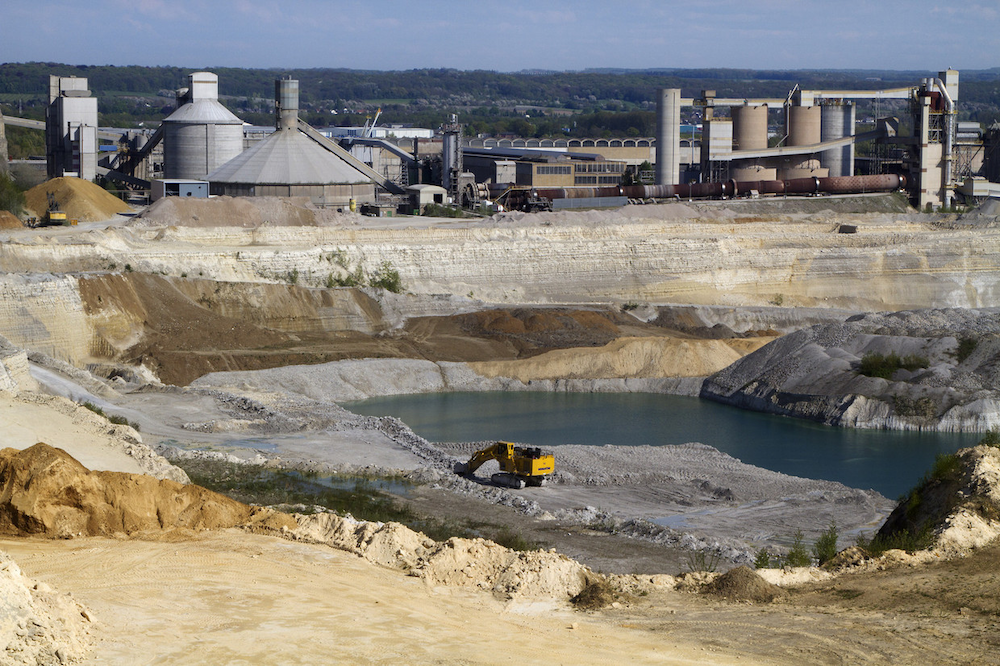 ENCI quarry and cement factory. Image courtesy of Hollandse Hoogte [12]
Regeneration and redevelopment
In 2020, the restoration works by Natuurmonumenten (Dutch nature conservation organisation) were completed and the old quarry was opened to the public to enjoy the expansive views, diverse nature and interesting historic fossils inside of the quarry basin.
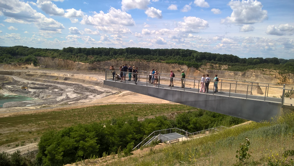 Viewing platform over the ENCI quarry. Image courtesy of Natuurmonumenten
[1]
Viewing platform over the ENCI quarry. Image courtesy of Natuurmonumenten
[1]
Future plans
The Mount St Peter area is designated nature reserve and is a favorite spot for many hikers, bikers and tourists. The old fort St Peter features guided tours and even the old marl caves can be visited. Plans to restore more nature around the quarry are already being discussed by Natuurmonumenten and the Maastricht municipality. Additionally, old ENCI quarry buildings will be transformed into new development hubs and studios.
Mount St Peter through time
Now that the story of Mount St Peter is told, take a look yourself at the changes that occured over time:
Sources
- [1] Natuurmonumenten - Nature reserve Mount St Peter Link
- [2] Regional Landscape institute Haspengouw and Voeren - Plateau van Caestert Link
- [3] Regional Landscape institute Haspengouw and Voeren - Mount St Peter Nature Link
- [4] Geology of the Netherlands - Mount St Peter Link
- [5] Kevin Amendt - Marlstone quarries at Mount St Peter Link
- [6] Eifelnature - Mount St Peter Link
- [7] ENCI - Restoring the Mount St Peter quarry Link
- [8] Visit Limburg - ENCI quarry tourism Link
- [9] ENCI quarry - Future works Link
- [10 Kleon3 - Link
- [11] Bouwmachines van Toen - Huub van Dijk Link
- [12] Hollandse Hoogte - Sijmen Hendriks Link
_en_Lanaye,_geologische_collectie,_Museum_Het_Land_van_Valkenburg,_Limburg.jpg)
Data sources
- Actueel Hoogtebestand Nederland - AHN1, AHN2, AHN3, AHN4 Link
- Rijksoverheid AHN information - Capture years of AHN1, AHN2, AHN3, AHN4 Link
- Google Maps / Landsat/Copernicus / Maxar Technologies / Aerodata International - Image data Link
- Atlas 1868 / J. Kuyper (1870) - Map data Link
- Rijksdienst voor het Cultureel Erfgoed / Ir. DC van Schaïk - Tunnel map data Link

Tools
- QGIS 3.22
- VS Code 1.71
- Three JS r144
- Adobe Photoshop 2022
Code at GitHub
GIS Minor 2022 - Assignment 1
University of Twente
Jannick Siderius - S2100282
© 2022